We have commented in these pages on the great privilege it was to exhibit some of the Library’s beautiful charts of the Chesapeake Bay at the Library of Virginia for the Vorhees Lecture of the Fry-Jefferson Map Society. The lecture took place last Saturday Mar. 31, and we worked diligently last week to select examples of the best of our maps and charts. It was hugely fun and a welcome break from the routine.
Thanks to the generosity of the Virginia Cartographic Society, we were able to take reproductions of 3 of the very rare maps collected by Bill Wooldridge, a great friend of the Library and a dedicated student and collector of maps. We selected Colom’s New Netherlands map of 1658, the Dudley Old and New Virginia map from book 6 of the Dell’ Arcano del Mare (1646), and the William Heather 1812 chart of the Chesapeake Bay.
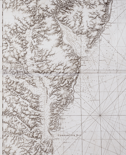
From our collection, we chose the Des Barres 1778 map from our very rare copy of the Atlantic Neptune, and our equally impressive copy of Dell’ Arcano del Mare books 1-4, containing a 1647 Virginia and Florida map (at that time, Virginia and Florida were the only colonies south of New Jersey). We also pulled a 1778 French map derived from Anthony Smith’s 1776 map, which indicates the ruins of Norfolk, burned by the British in January 1776. Ours is strikingly hand-colored and the engraving is considerably enhanced over the Anthony Smith map which, just the next table over, the Library of Virginia’s Map section was also displaying! We pulled a 10-foot long 1808 Laurie and Whittle entitled “A New and Accurate Chart (from Captain Holland’s Surveys) of the North American Coast for Navigation between Cape Cod in New England and the Havanna in the Gulf of Florida,” with their 1816 sailing directions in a separate volume. Finally, we picked a whole series of maps done by the U.S. Coast Survey and its successor organization, the U.S. Coast and Geodetic Survey.
The stars of our show were clearly the books. The map experts, of which there was an abundance, were in awe of our Atlantic Neptune, often peaking under the map to make sure that it was indeed affixed to the binding of the book! A few expressed so much interest in our fragile Dell’ Arcano del Mare that we opened the book up for them and showed them the bottom of the Virginia and Florida map, too delicate for us to open fully. A close runner-up to the books was the 1808 Laurie and Whittle. It seems that size does matter to map collectors, and a 10-foot example was enough to keep several people at our table for 30 minutes or longer!
The talks on the Bay were of course excellent. No one who sails the Bay needs to be reminded of the struggle to preserve it as a habitat for underwater vegetation, for aquatic and avian life, and even for human populations on the islands which are breaking up and disappearing with rising sea levels. To see that sea level has been rising on the order of 3 mm a year every year since the industrial age began was sobering. 3 mm may be a slow rise, but it is inexorable and accelerating. Thanks to the Fry-Jefferson Society for providing us at The Mariners’ Museum with the opportunity to participate in the important discussion that continues to bring new scientific findings to light.