Good afternoon, readers!
Mariaelena DiBenigno is a special guest blogger today as a graduate student in the William and Mary American Studies Program. She has been an intern with us for a few months and she has been working exclusively with our rare map collection. In addition to cataloging these resources, she’s been on the hunt for something more…
Read on to see what she has been up to!
While cataloging The Mariners’ Museum Library’s collection of sixteenth, seventeenth, and eighteenth century maps, I have also been scanning the illustrated seas for the unusual, the astonishing, and the monstrous. Part of my current project involves searching for depictions of sea monsters in the oceans, near land and along the edges of the maps. Fortunately, this rare map collection contains a multitude of sea monsters, as you’ll see below.
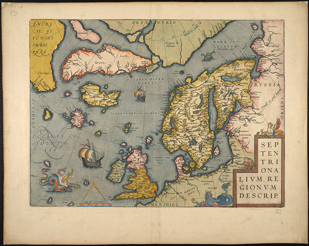
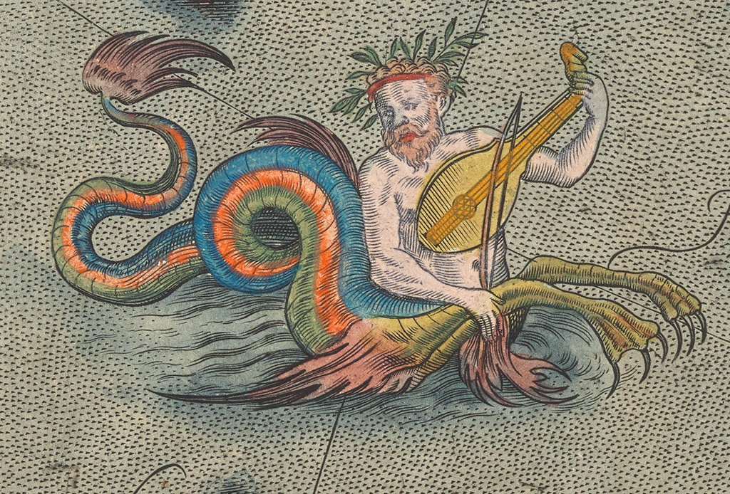
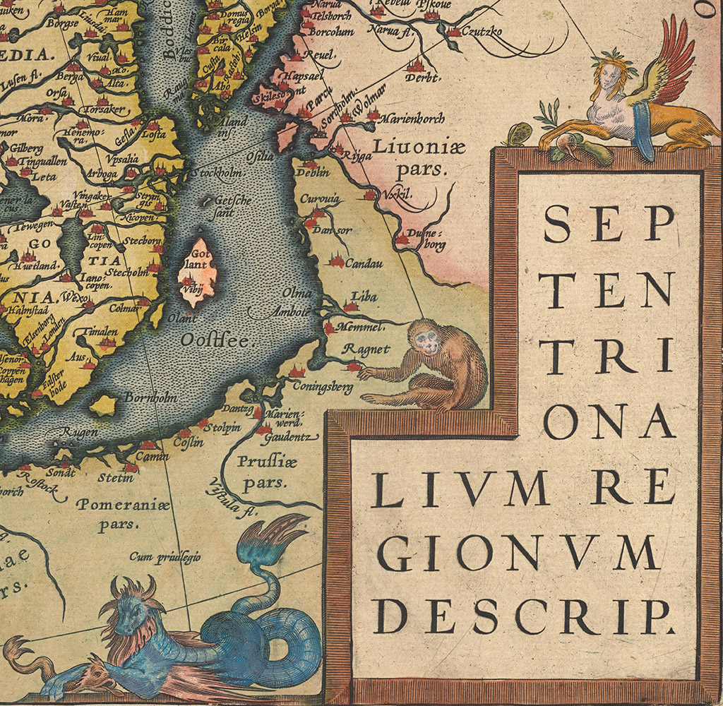
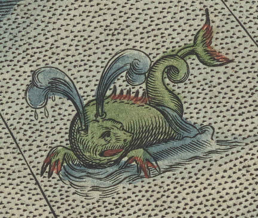
In the map, Septentrionalivm regionvm descrip. (MSM0125) by Abraham Ortelius, 1592, there is a colorful ichthyosaur gracing the waters off the coast of Ireland as he plays a mandolin in the lower left corner. There are also images of the whale-like physetera, or spouter, and its counterpart, the large-bodied cetus.
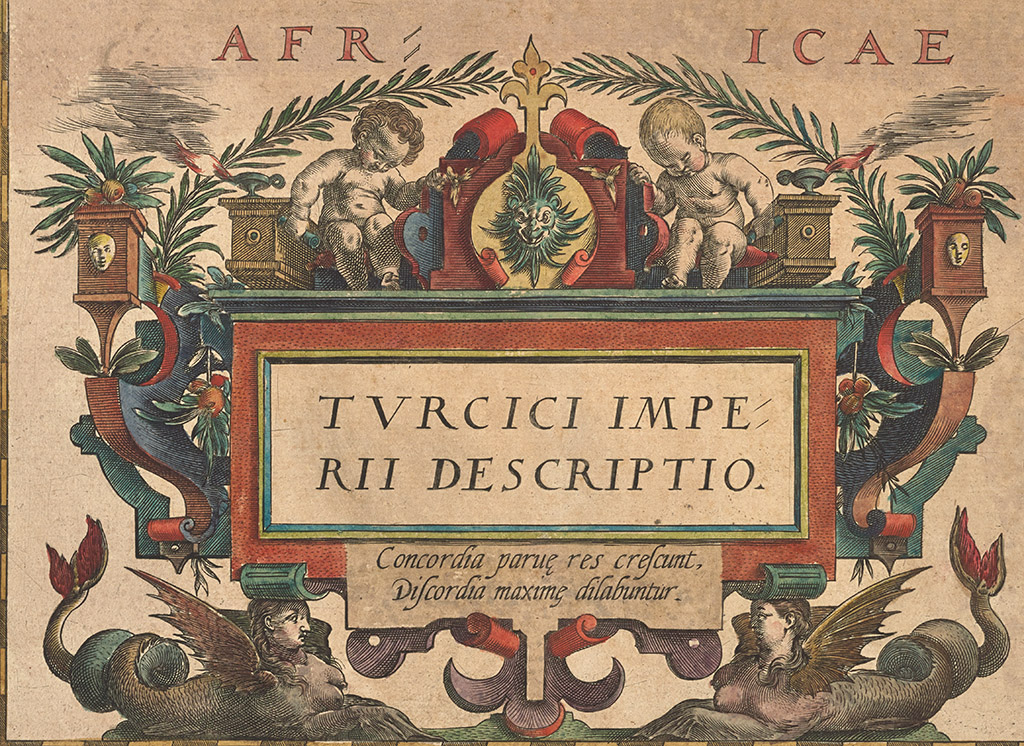
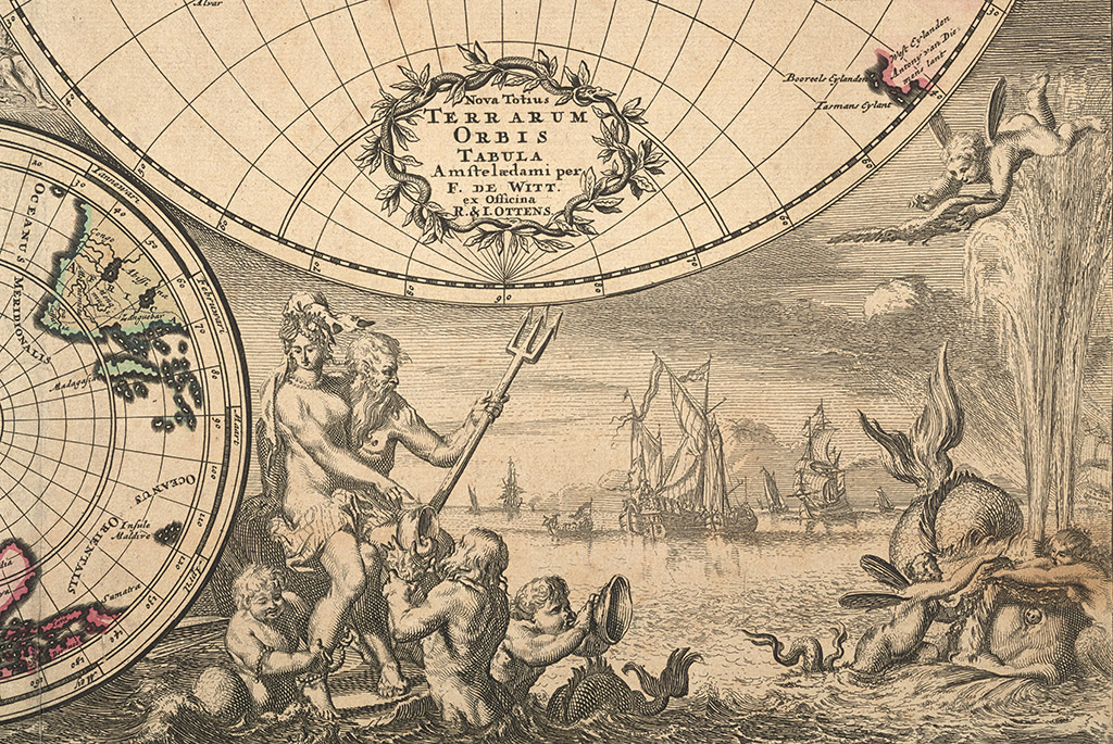
All manner of mermen and mermaids decorate seas. On several cartouches, like the ones below, strangely cherubic creatures with fish tails romp about.
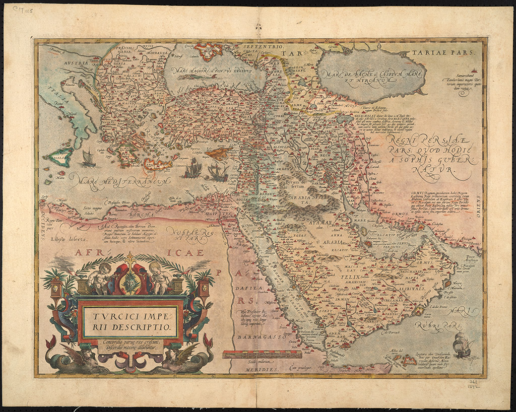
Below, the map Tvrcici imperii descriptio. Concordia parue res crescunt, discordia maxime disabunter (MSM0115), by Abraham Ortelius in 1592.
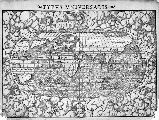
Below, more cherubs are featured in the map, Typus Universalis (MSM1712) by Sebastian Münster, 1540.
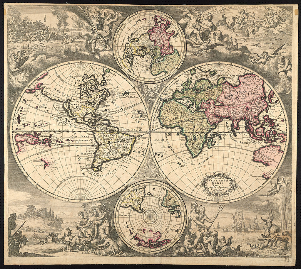
Very few maps in the collection depict menacing sea monsters, although one seventeenth century text, Architectura Navalis, shows sailors shooting galley cannons at three threatening sea creatures from the map Nova Totius Terrarum Orbis Tabula (MSM0001) by Frederik de Wit, 1660.
I have learned that sea monsters serve three purposes on maps:
1. They display the great oceanic unknown to audiences with atlas access.
2. They demonstrate a community’s desire to frighten away enterprising foreign fishermen.
3. They simply help decorate large swathes of sea.
While we can’t always be sure what each individual sea monster represented, we do know that these illustrations were replaced with ships in the early eighteenth century. As the seas became more and more charted, the age of the map-based sea monsters came to an end.
I am sure that Maria will uncover several more sea monsters in our rare map collection during her stay with us. Just keep in mind that you are always welcome to drop by the Library to see them in person!