Celebrating International Day of Women, Girls in Science, and Black History Month!
Each year on February 11, we celebrate the International Day of Women and Girls in Science. The day is meant to honor and celebrate the contributions to the sciences made by women and girls globally, and take a stance of commitment to continually expand the sciences to be more accessible and inclusive to women and girls.
We wanted to share in this international celebration by highlighting the work and career accomplishments of American mathematician and local Virginian, Dr. Gladys B. West, especially in her work with laying the groundwork for modern electronic Global Positioning System (GPS) technology. Dr. West and her team shaped the mathematics and technology behind GPS.
Additionally, we are celebrating Black History Month at The Mariners’ Museum and Park. Dr. West shattered glass ceilings and broke barriers for women of color in mathematics and other STEM fields because of her persistence, abilities, and hard work. She is a phenomenal woman!
Dr. Gladys B. West

Dr. Gladys B. West is a Virginia native, born south of Richmond in Dinwiddie County. She made her way from a one-room school-house to getting her Bachelor of Science degree, a Master of Arts, and a Master of Science degree as well as her Ph.D. As a mathematician, Dr. West worked with the Naval Proving Ground (today the Naval Surface Warfare Center) in Dahlgren, Virginia, beginning in 1958 and retiring in 1998.
Dr. West has had an incredibly accomplished career in mathematics over her 42 years of service! After starting her career with the Navy, Dr. West focused her work on astronomical studies in an effort to understand how Pluto and Neptune moved in relation to each other in the 1960s. From this study, she then began to analyze data from satellites to create better mathematical models of the earth. As part of the Seasat radar altimetry project, Dr. West developed systems that allowed satellites to perform remote sensing in oceans.
In the 1970s and 1980s, she programmed early computers to better model the actual shape of the earth using data from satellites. Dr. West worked with the Navy until the late 1990s, and in her many years of work, her contributions laid the foundations for modern GPS, allowing for increasingly accurate models of the earth’s surface to be developed (called a geoid), a necessity for having our GPS work today!
We are only beginning to scratch the surface when it comes to her contributions and her story. Check out her new memoir, It Began with a Dream, to learn more about her amazing career and life. (See the end of this post for more articles and sources about Dr. West’s life and career accomplishments.)
Why is Dr. West’s work significant to GPS?
The term Global Positioning System (GPS) is quite common to most people today, and it’s become vital to the modern world. We use this important constellation of satellites in our daily lives for traveling, creating maps, tracking locations, telling time. We have Dr. West to thank for this amazing technology! Thank you!
Let’s take a step back and explore how modern electronic GPS works and how Dr. West and her team made GPS possible for us today.
The Global Positioning System technology in the United States of America, currently run by the U.S. Air Force, uses at least four satellites. Radio signals are transmitted to Earth constantly by orbiting satellites. The closest satellites pinpoint your location through trilateration which is a process that uses time to measure distance (distance = rate x time). As the satellites communicate with each other and the devices on Earth, the satellites need a detailed model of Earth that contains the surface elevation (so the system can work more effectively).
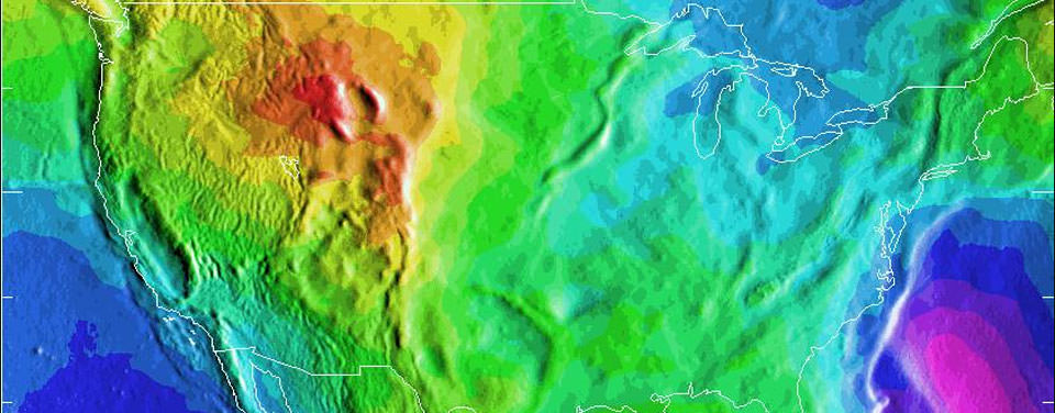
When creating a mathematical model of earth, geodesists, the people who measure and monitor the shape of Earth, often regard the Earth as a “bumpy potato”– uneven and irregular. Dr. West and her team in the late 1970s and early 1980s developed a detailed mathematical model of the Earth called a geoid, which “defines zero elevation” and accounts for the surface of the Earth being irregular (along with the factors of gravity). The more accurate the mathematical model of the Earth is, the more accurate GPS is!
Dr. West in her career carried on the traditions of many scientists and explorers before her. These explorers went to great lengths to measure the shape of the Earth, improving navigation before electronic GPS.
Tools used before modern-day GPS
Before the advent of electronic GPS and satellites in the 20th century, navigators for the previous centuries relied upon analog navigational instruments. A few objects that relate directly to pre-GPS instruments include astro-compasses, quintants, and theodolites (thee-aa-di-lait), all used to measure the shape of earth and improve navigation. These tools were used to navigate, survey, and create maps. Here are a few examples of those instruments we have in The Mariners’ Museum and Park’s collection.
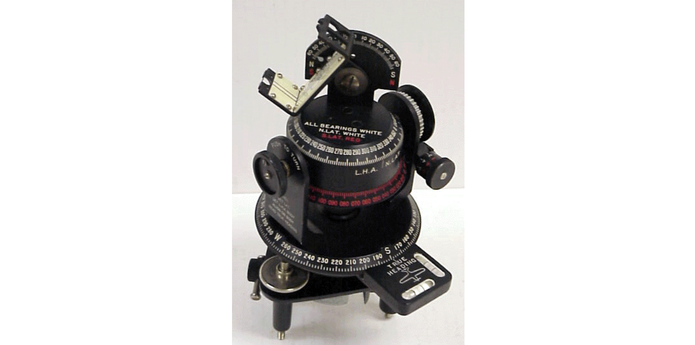
Astro-compasses measure true north by using the positioning of celestial bodies. This type of compass was put into use mostly during polar exploration. It was one of the most reliable ways to determine north in the polar regions, something we take for granted in modern GPS. Other types of compasses, like magnetic compasses and gyrocompasses, were not useful in the poles. A gyrocompass is essentially too close to Earth’s rotational axis point to work, and the magnetic needle in a traditional magnetic compass is essentially vertical (indicating geographic north) at most locations near the poles.
The pictured astro compass is made by W.W. Boes Company (Dayton, OH), circa 1944, and part of the Peter Ifland Collection at the Museum. It was also used for aviation. It is made of plastic, glass, and metal.
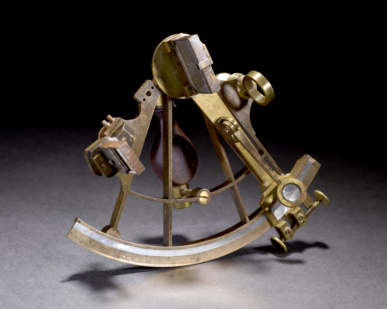
A quintant is a portable, reflective instrument with an arc of 72 degrees. It is similar to a sextant in that it uses mirrors to assist in measuring angles; however, with a larger arc, it can measure a larger range (and is more precise). It was used to measure lunar distances. The pictured quintant was created by E. Lorieux (Paris, France) circa 1870 and used by the then-called United States Coastal Survey, likely for creating geodetic surveys. It is made of brass, glass, and silver.
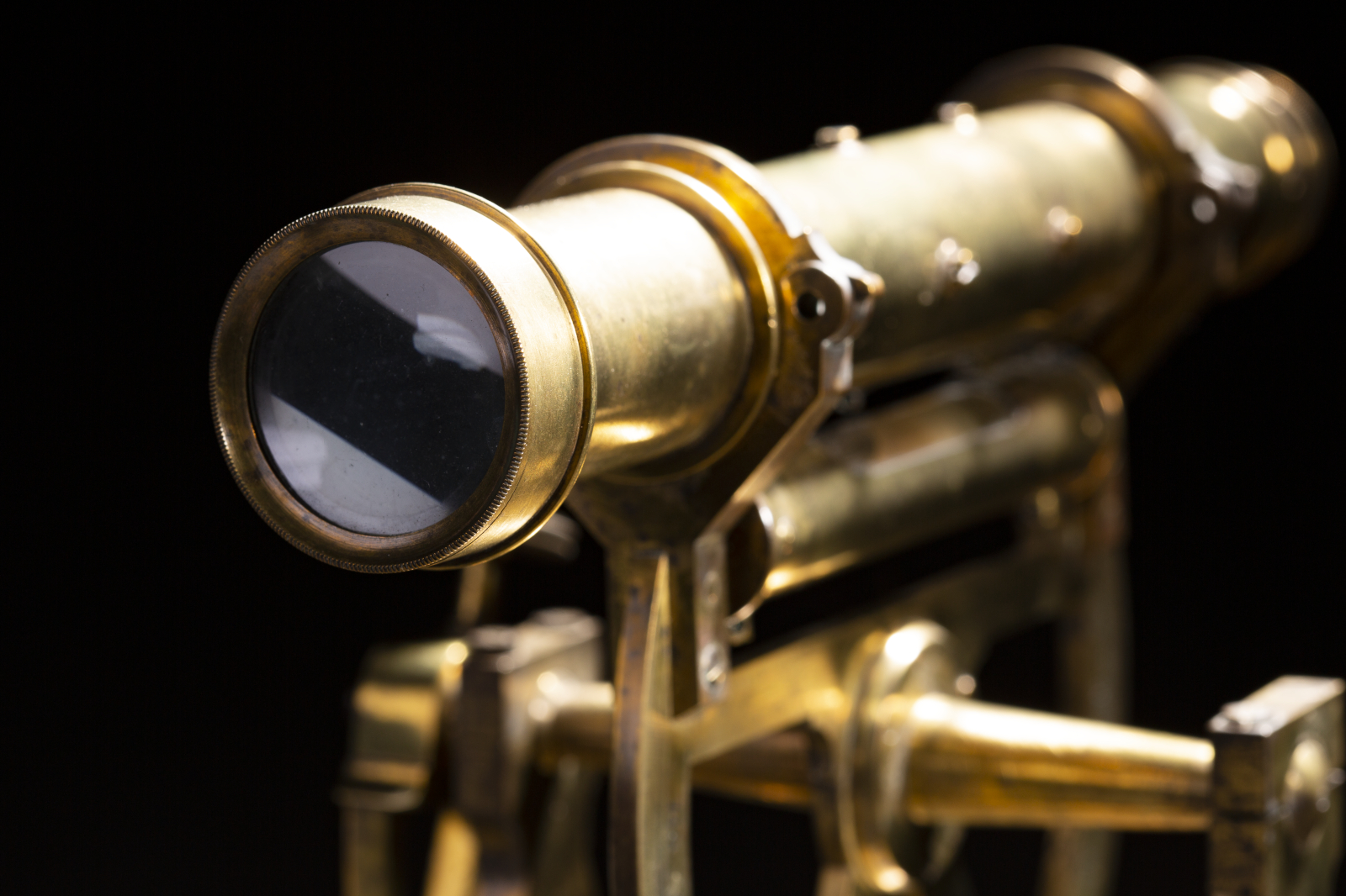
A theodolite is a calibrated optical instrument that determines relative positioning through triangulation (measuring angles). Similar to a surveyor’s transit, the theodolite has a telescope fitted with a level and mounted on a tripod. Theodolites can measure vertical and horizontal angles because the instrument’s base has the ability to swivel and rotate.
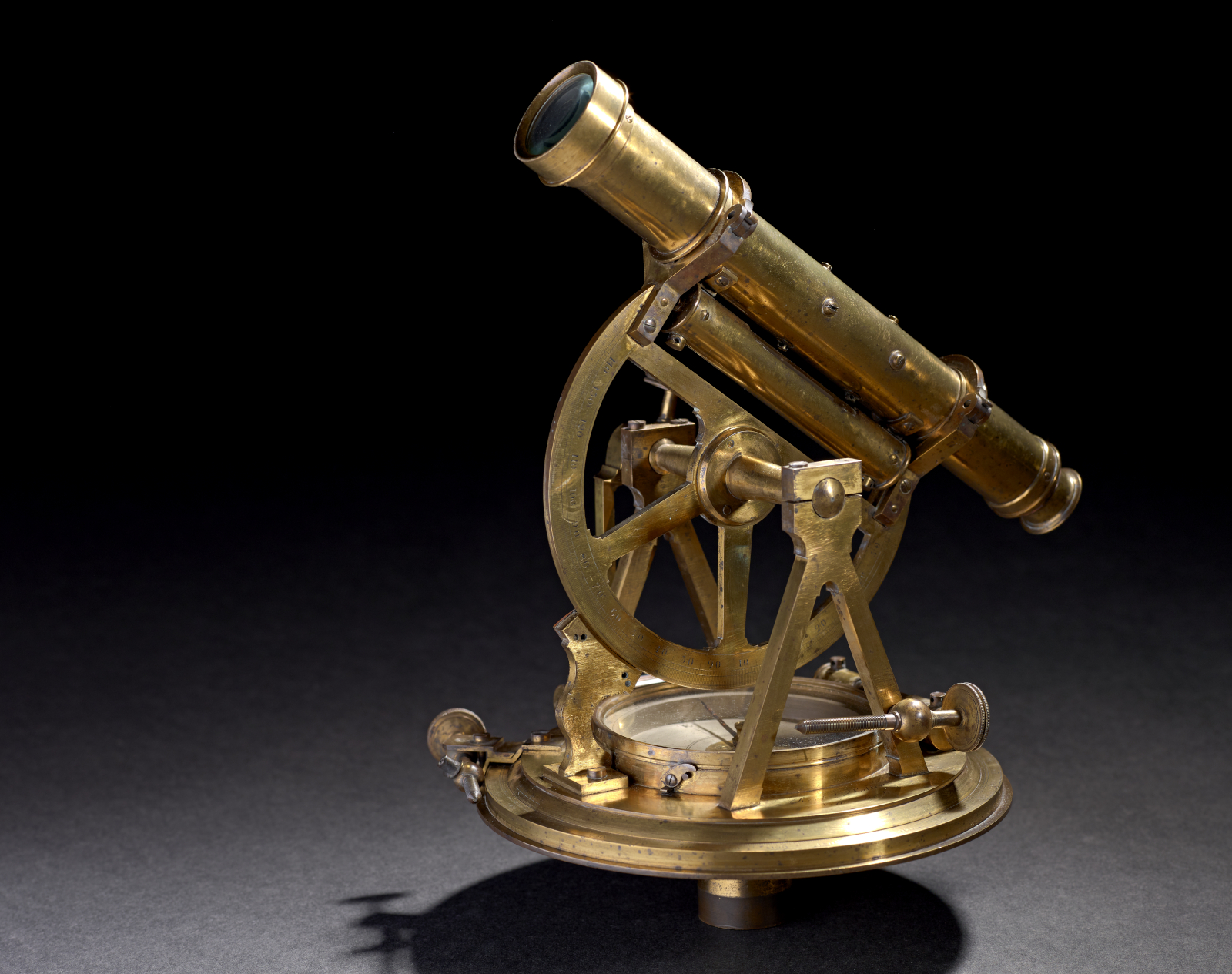
This instrument can be used in surveying, navigation, geology, meteorology, and other sciences. Surveyors still use modern-day theodolites in addition to other well-known instruments like a transit, which are usually perched atop a tripod. The theodolite pictured above is made by Richard Patten (New York, NY) circa 1820. It is made of brass and glass.
Keep a lookout for another woman who reshaped the world in March during Women’s History Month! More reading, listening, and sources:
Learn more about United Nations International Day of Women and Girls in Science.
Read more information on African American History Month.
About Dr Gladys B. West:
To learn more of Dr. West’s story, check out her memoir, It Began With a Dream, by Dr. Gladys B. West, and Mr. M.H. Jackson.
For a quick discussion of her work in the field of geodesy, see the podcast about her from Command Line Heroes: Season 6 Episode 2: Dr. Gladys West – The Mathematician Who Reshaped Our World
https://massivesci.com/articles/science-heroes-gps-hidden-figures-scientist-women-physics-math/
https://www.un.org/en/observances/women-and-girls-in-science-day
https://www.theguardian.com/society/2020/nov/19/gladys-west-the-hidden-figure-who-helped-invent-gps
https://www.bbc.com/news/world-43812053
https://apnews.com/article/2dee50a4b3be4564b417f7f569b38ba4
https://en.wikipedia.org/wiki/Gladys_West
Instruments
Astro compass: https://catalogs.marinersmuseum.org/object/CL26228
Quinint:https://catalogs.marinersmuseum.org/object/CL9686
Theodolite: https://catalogs.marinersmuseum.org/object/CL28552
More GPS and related information:
https://timeandnavigation.si.edu/multimedia-asset/how-does-gps-work