On October 17 – 20, 2024, a community science event called “Catch the King,” led by Wetlands Watch with the support of numerous local environmental partners, including The Mariners’, will enable the community to help monitor flooding from king tides in coastal Virginia.
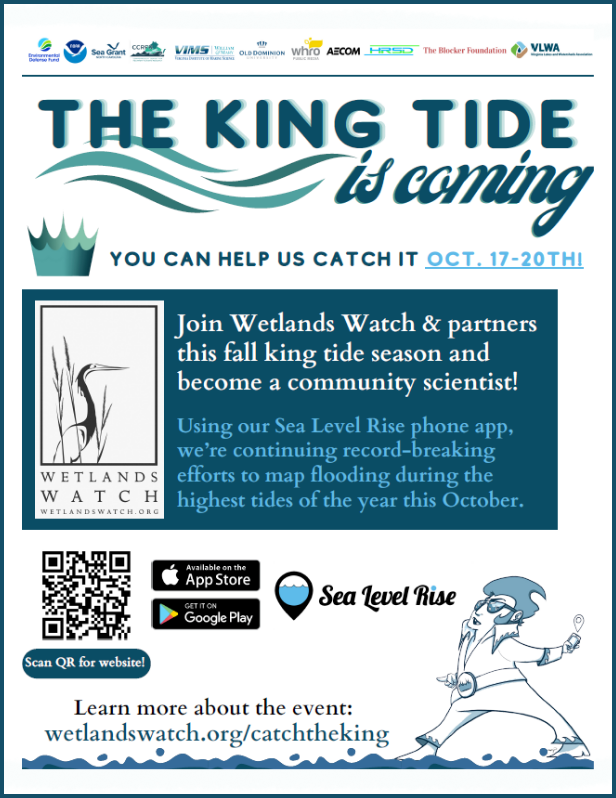
The purpose of “Catch the King” is to measure and map the local effects of the king tides, which the Virginia Institute of Marine Science (VIMS) defines as <3.5 ft. above mean low low water (MLLW). High tides are seen as <3ft above MLLW. “Catch the King” data collected by participants in coastal Virginia on the app will contribute to the VIMS interactive flood model mapping program.
How Can I Participate?
In early September, a training session was co-hosted at The Mariners’ Museum and Park encouraging local community members to participate. If you missed the various training sessions in the area, there are resources from Wetlands Watch you can explore to help you prepare for the event.
To participate, community members will need to download the app and follow the instructions provided by Wetlands Watch. This step is recommended before the event! For more details, please visit Wetlands Watch’s website.
We also want to put Newport News and the Peninsula on the map! Our very own Trail Supervisor, Ioan Yamakov, put out more than 900 pins for the event last year! Let’s see if we can beat his record while getting points for Newport News and the surrounding areas on the Peninsula!
What is So Kingly About a King Tide?
Let’s take a step back and explore the tides on Earth. Tides are long-period waves rolling around Earth’s oceans. Throughout the seasons on Earth, the Moon and Sun “pull” the waters around Earth, an astronomical water dance, creating those regular tides we’ve all come to know and love. In our area, we experience two high tides and two low tides within 24 hours. Our regional tidal pattern is called semidiurnal where one of the high tides is highest and one of the low tides is lowest.
The Moon, the closest satellite to Earth, has the greatest influence on our daily tides, even more so than our mighty Sun. Once in a lunar cycle (a cycle is 29.5 days on average), the Moon is in perigee, meaning the Moon is the closest to Earth in its elliptical orbit. This phenomenon can lead to slightly higher tidal ranges because of increased gravitational pull. When the Moon is farthest from Earth, in apogee, this can lead to slightly lower tidal ranges due to lower gravitational forces.
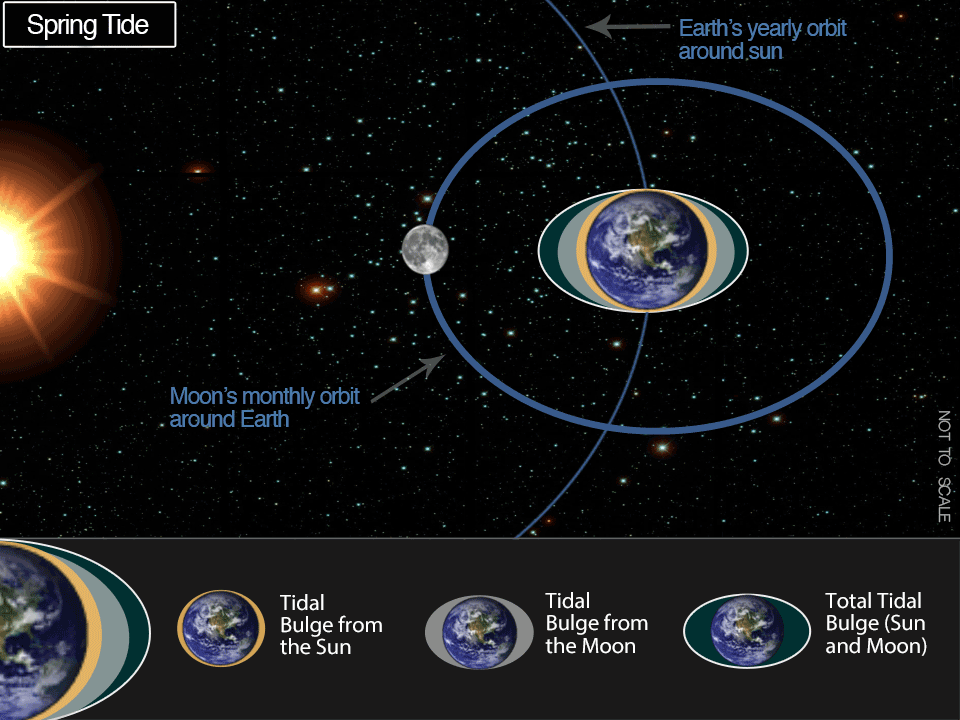
Spring tides happen twice a lunar cycle during a new or full moon. Spring tides reference not the season, but the idea of “springing forth” and result in higher tides. A neap tide happens seven days after a spring tide, resulting in more moderate high tides and slightly higher low tides.
Approximately 6-8 times an Earth year, the Moon will be in perigee and there will be a new or full moon, causing a perigean spring tide. If the conditions are right, these perigean spring tides can lead to king tides. In coastal Virginia, we typically see king tides in autumn when the Earth, Moon, and Sun are aligned. These tides can be predicted based on long-term tidal data. The king tides in our area are based on the tidal data from Sewells Point in Norfolk. Not only do we have this astronomical alignment, but in Virginia, as Wetlands Watch explains in a 2017 post, we are contending with increased rainfall, flat rivers, and wind during this time of the year, which can make the tidal flooding from a king tide even greater. These tidal flooding events, not connected to rainfall, are often called sunny day flooding or nuisance flooding.
Does The Mariners’ Museum and Park Deal With Flooding?
The simple answer is yes. Apart from our James River shoreline, we typically do not deal with tidal flooding in our Park, but there is still quite a bit of flooding happening for other reasons. Along our James River coastline, we are most concerned about erosion. Tides and long-shore drift can transport sediment along the river coastline and lead to erosion on our shores, something we are trying to prevent with different solutions.
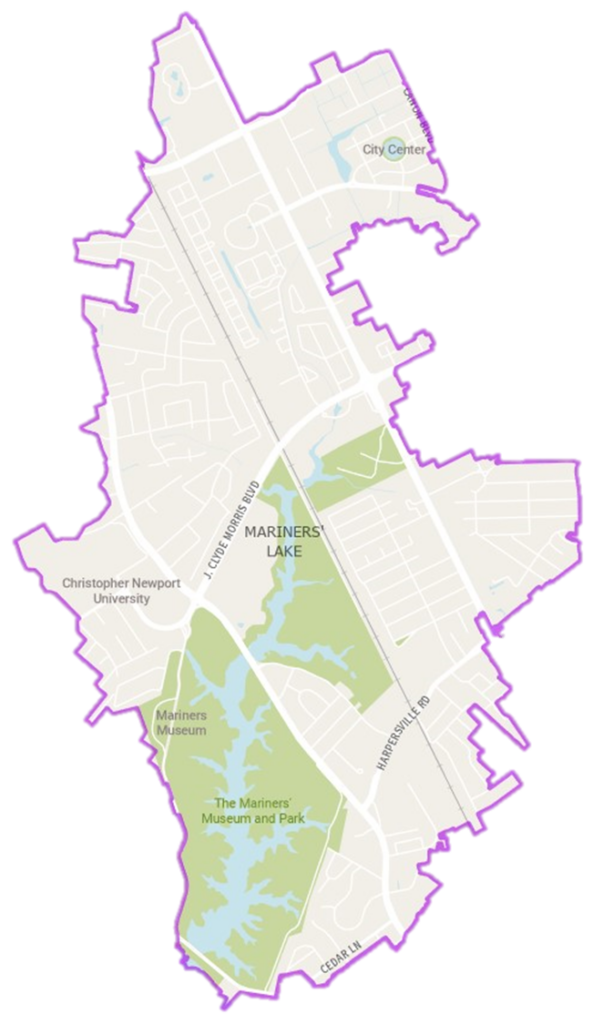
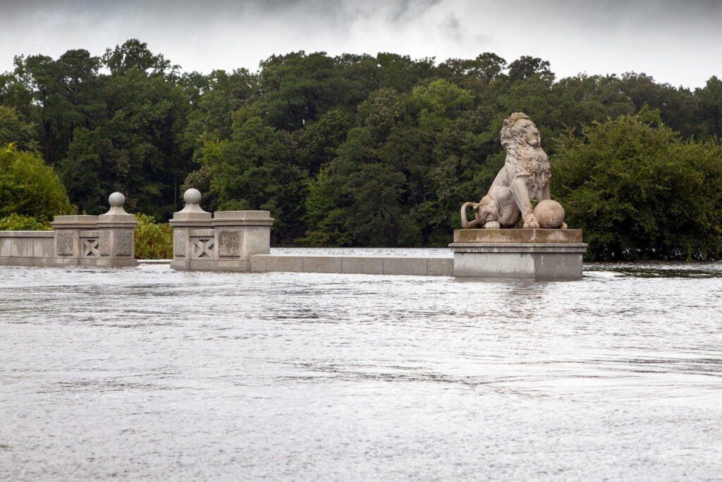
Mariners’ Lake is a man-made freshwater lake and is therefore not subjected to tidal forces. High winds and heavy, frequent rainfall, on the other hand, are issues we do contend with. Think about those “rain bomb” events that produce a lot of water in a very short period of time or hurricanes that come through and bring a lot of rain. Those events overwhelm our stormwater systems for many reasons, including increased impervious surfaces, and can lead to flooding in our local watershed around Mariners’ Lake. The Park staff have a procedure to regulate the Lake levels if there is high rainfall predicted. The earthen dam (Lions Bridge) can overtop if the rainwater is too much in a short period of time, but this happens very rarely. The image below is Lions Bridge flooding from 2012 around a strong storm that produced about 2” per hour of rain for several hours.

The watershed area of Mariners’ Lake is 4.8 mi² (or 3,088 acres). That means, when it rains within our watershed, pollution from City Center to Christopher Newport University comes to our Lake. Mariners’ Lake and Kettle Pond act as stormwater best management practices (BMPs) and part of their purpose is to settle out the local stormwater runoff pollution before heading into the James River. The amazing forest around the Park, along with other native plantings and gardens we’ve created over the years, help to slow the flow of water coming into our Lake. By slowing the flow, the forests are producing many benefits, including reducing erosion of our Lake shoreline.
Why Does This Matter? It’s Just the Tides!
Water is one of the most powerful forces on Earth. You don’t want to mess with water, especially when it comes to the untold damages of flooding. Maybe you don’t see a ton of flooding personally, or you think there aren’t consequences in your life right now, but in our area, most communities are experiencing the negative effects of flooding. Scientists predict that the king tides we see only a few times a year give us a sneak peek into the future of increased sea level rise, especially in a low-lying coastal area like Hampton Roads.
So there is more flooding– I’ll just take my boat, you might say. If we are looking at recreation, for example on the James River, then you know that interacting with the water can at times be risky. With high bacteria levels during certain times of the year, it’s not always safe to use these beaches to swim or access the River.
Where does all of this bacteria come from? Stormwater inflow into our River brings bacteria, debris, and other pollutants, especially with a concentration of impervious surfaces. The bacteria comes from natural and made-made sources. If there is a large amount of rainfall, it could overwhelm the local wastewater systems causing bacteria issues in our waterways.
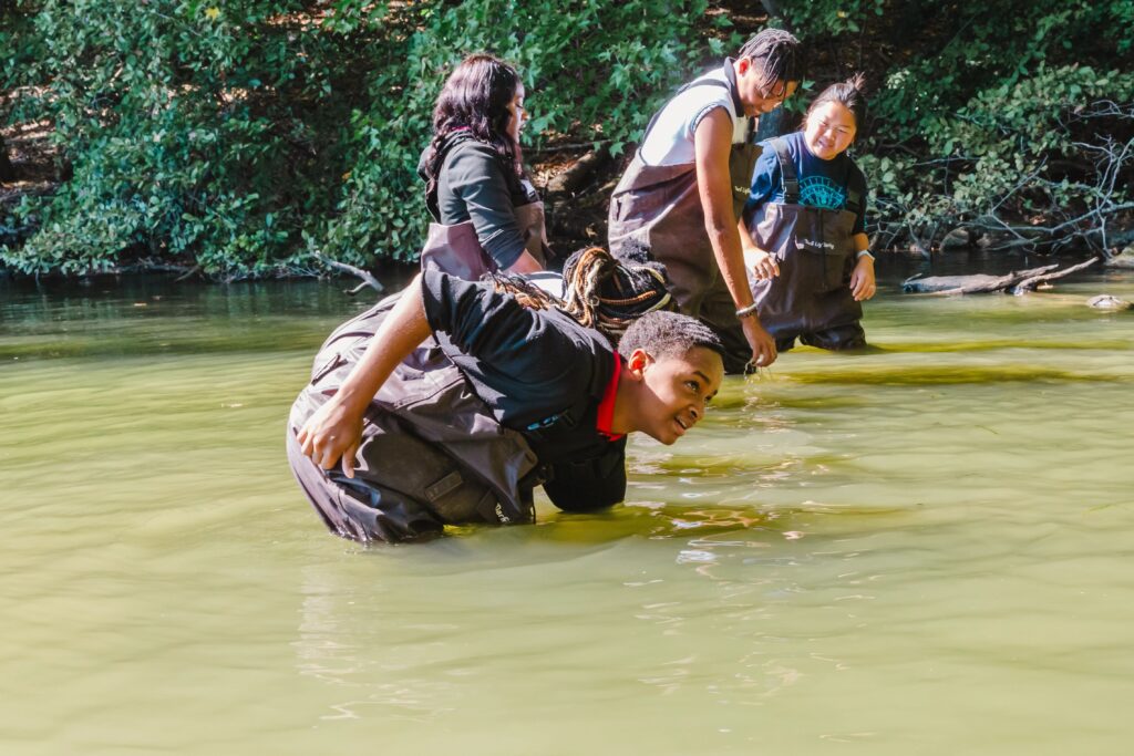
When you add tidal flooding in the James on top of that, it can only make these issues worse. Flooding from runoff or tidal flooding can carry debris, sediment, and pollutants into waterways. On this note, Alyssa Bucci, a graduate student at Old Dominion University (ODU), is simultaneously leading the efforts this year on a related ongoing community science effort called “Measure the Muck” which determines the nutrients and bacteria entering our waterways around these flooding events.
Excessive and persistent inundation from a constellation of causes, amplified by climate change, poses major threats to our community’s infrastructure, health, and environmental impacts. The causes of these flooding issues are a combination of sea-level rise, continental sinking, higher high tides, increased impermeable surfaces, and the list goes on. Some of these causes are totally out of our control, but some are well within our hands.
A positive to all this is that the Park team at The Mariners’ has been monitoring the Lake water since 2018. We’ve been tracking important parameters such as temperature, turbidity, nutrients, and e.coli, which has given the team a sense of what is normal and healthy for Mariners’ Lake.

What are the Solutions?
Nature-based solutions are one way our communities can improve the harsh effects of flooding, among other issues. A nature-based solution can include projects like native rain gardens, living shorelines, and wetland restoration.
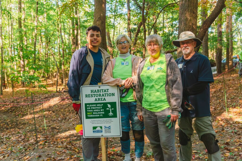
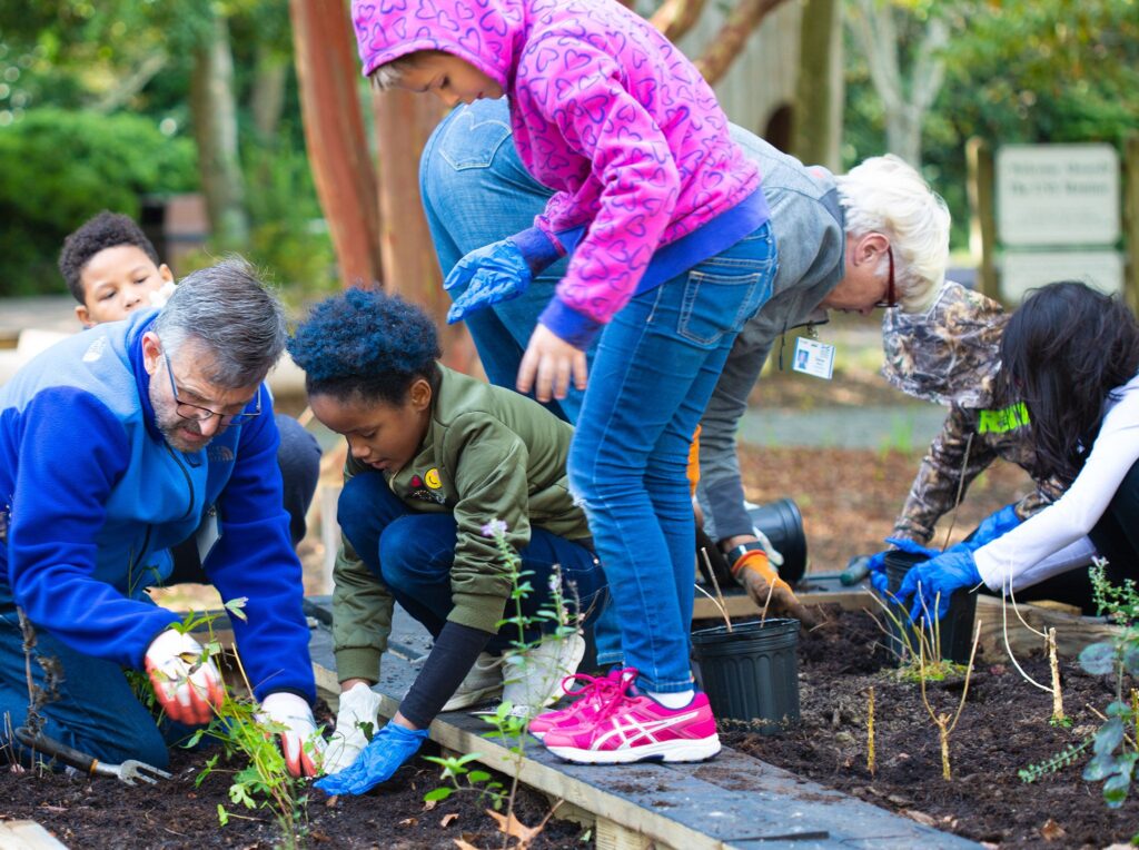
Right here at The Mariners’, our Lake Stewards program with local 9th graders hones in on teaching students nature-based solutions and makes them part of the solution by having students install native eelgrass in Mariners’ Lake. Our early childhood programs also encourage kids to plant native seeds, including a lovely flower called Blazing Star!
Beyond nature-based solutions, there are other meaningful ways you can help in your community! Anyone can participate in “Catch the King” or other community science events! The Mariners’ has strong connections with groups in the area who lead community science efforts right here in Mariners’ Park, including, but not limited to, Peninsula Master Naturalists, Newport News Master Gardeners, Frog Watch USA (through the VLM), and more! If you don’t want to be part of something as formal, you can always get on apps like iNaturalist, eBird, and Sea Level Rise to enter data on your own time.
The effects of flooding and climate change have an impact all around us– you can help document those changes and help fuel solutions even by simply entering data into a community science app! Every bit helps, and we need your help!